WALK ABOUT ZION
By
Jon (Yoni) Gerrish
With
Jim Gerrish
All photos are by the authors unless otherwise credited
All Scripture quotations in this publication are from the Holy Bible, New International Version, except where noted (published by Zondervan Corporation, copyright 1985).
Copyright © 2008 Jon Gerrish
“Walk about Zion, go around her, count her towers, consider well her ramparts, view her citadels, that you may tell of them to the next generation” (Psalm 48:12-13).
Church Israel Forum is happy to provide a virtual tour around Jerusalem’s Old City. Begin now to fulfill a biblical command (at least in a cyber sense) to walk around Holy Jerusalem. While doing so, learn of her and use the opportunity to pray for the peace of the beloved city.
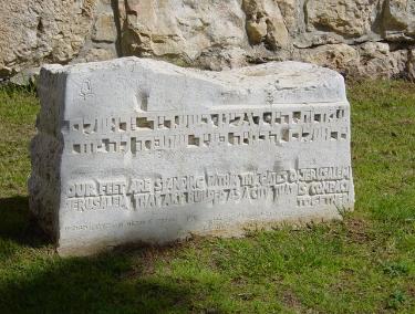
Near the northwest corner of the Old City is this stone with a quote from Psalm 122:2:
“Our feet are standing within thy gates, O Jerusalem.”
***
Jerusalem’s famous Old City (often referred to as Zion) is approximately one square kilometer in size. It is enclosed by an impressive wall, built by the Ottoman ruler, Suleiman the Magnificent, in the years 1536-1540. For the 320 years prior to that time the walls of the city had remained in a breached condition.
It is important for us to realize that this enclosed Old City was the only city of Jerusalem until shortly after the middle of the 19th century. It was only then that people began to live outside the city walls.
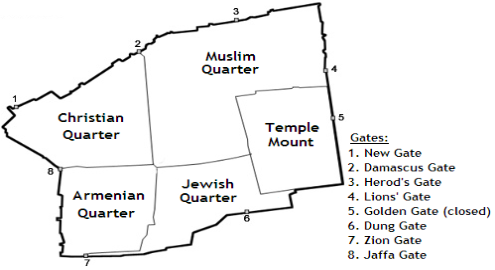
The Old City is divided into four quarters: the Christian Quarter; the Muslim Quarter; the Armenian Quarter and the Jewish Quarter. It also contains the ancient Temple Mount. The city today has a population of approximately 35,000 people, including over 25,000 Muslims, almost 6,500 Christians, and just over 3,000 Jews.
As we walk around the city we will notice its massive walls. They are approximately 10 feet (3 meters) thick at their base and 16-49 feet (5-15 meters) high. We will also notice its towers (35 in all). Also we also notice its many battlements and overhanging parapets for defense of the gates. We will particularly notice the gates themselves. There are eight of these gates and they all are open today except one.
^
North
Old City map, courtesy of Wikimedia Commons
“This is Jerusalem, which I have set in the center of the nations, with countries all around her” (Ezekiel 5:5).
THE NORTH WALL
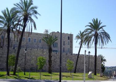
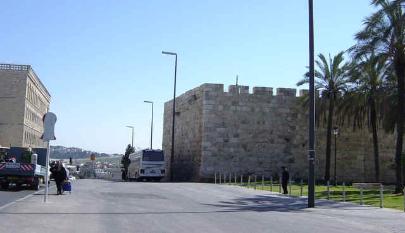
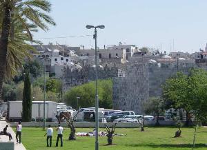
Our virtual tour begins at the northwest corner of the Old City near Tsahal Square (Israel Defense Forces Square), and we will be walking northeast along the ancient wall toward Arab Jerusalem. In this northwest corner we are greeted by a pleasant green park with olive and palm trees. Some of the archaeological remains uncovered in this park go back to Crusader times.
Now we view our pleasant park from the north and across the street. We can see the corner of the western city wall to which we will return at the end of our journey.
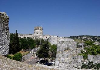
We notice how the College Des Freres building towers above the ancient wall. This structure houses the De La Salle Boys School.
As we exit our lovely park we turn north toward nearby Ha Tsankhanim Street (Paratrooper Street) and we catch a view of the St. Louis French Hospital for the terminally ill. This hospital was inaugurated in 1881 at its present location.
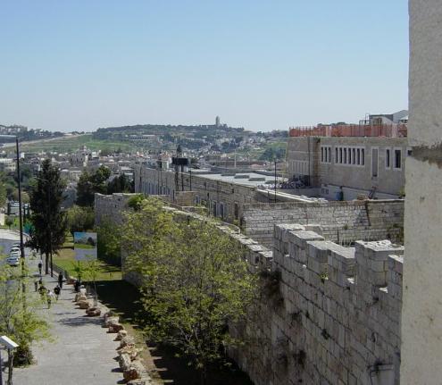
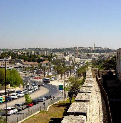
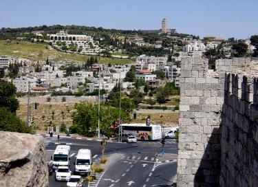
Our wall now makes a right turn and from this corner we will continue our walk in a northeasterly direction along Paratrooper Street. In the distance we can see part of Mt. Scopus and the Hebrew University.
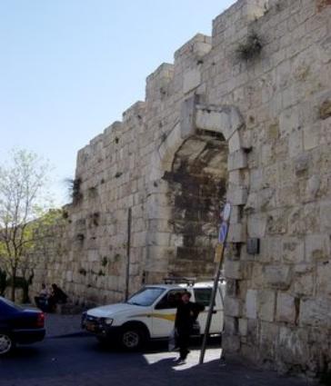
Immediately we encounter the first gate of the city and the newest one. It was built in 1889 in an agreement between the Turkish Sultan and European powers. Its purpose was to provide access between newly constructed Christian buildings just outside the Old City with the Christian Quarter itself. It was given the appropriate name, “New Gate” (#1 on the map above). This gate marks the highest point of all the city gates, at 2,591 feet or 790 meters. It is possible that some sort of gate once stood near this location in Crusader times. However it was later closed.
New Gate
“Your gates will always stand open, they will never be shut, day or night” (Isaiah 60:11).
As we peek into this gate and into the Christian Quarter we see part of the small commercial area. We can also glimpse the boys’ school we mentioned earlier.
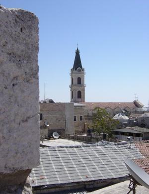
Now let us climb up on top of the wall for a bird’s eye view inside the city. We see towering above the wall the clock spire of St. Savior Monastery. This large complex was begun by the Franciscans in the early 1600s. The church building itself was added only at the end of the 19th century.
The spire of St. Savior church and monastery
The Christian Quarter is known for its many churches and church institutions. Among these are the various seats of church government in the Holy Land. There is the Latin Patriarchate, the Greek Catholic Patriarchate, the Greek Orthodox Patriarchate, as well as the Ethiopian and Coptic Patriarchates. In addition the Christian Quarter contains the very large complex of the Church of the Holy Sepulcher along with the Redeemer Lutheran Church and its tall tower. We will get a closer look at some of these later when we come to the last leg of our tour. That will be along the western edge of the Christian Quarter.
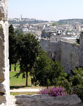
In order to better orient ourselves, let’s take a quick look from atop the wall near the New Gate. We find ourselves looking in the distance at the end of Mt. Scopus and the beginning of the Mt. of Olives. The square-looking tower we see in the distance is Augusta Victoria Hospital. We will take a closer look at this from the eastern wall.
Along the inside of the wall we get another view of the massive St. Savior monastery and church. We realize that this facility is being expanded once more.
Now we continue with our walk toward Arab East Jerusalem and the Damascus Gate. We notice that across the street to our immediate left we get a view of the Notre Dame complex. This was completed in 1904. It first served as a monastery and hospice for pilgrims and presently serves as a Christian hotel. The building was badly damaged in the 1948 war but has since been restored and renovated.
Notre Dame
It is best to look again from atop the wall to gain some perspective. As we walk leisurely along the wall we notice that we are getting closer to the market areas of Arab East Jerusalem. One of the busiest places in this market area is located around the Damascus Gate. We will arrive there soon.
Once again we find ourselves looking up to Mt. Scopus, Hadassah Hospital and the Hebrew University in the distance. We notice that our wall makes a jog to the south and then back to the northeast. We find ourselves looking down on another beautiful park and garden area.
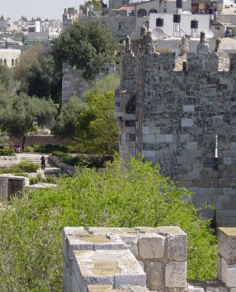
As we journey further atop the wall and as it continues northeast we are soon treated to a view of the Old City. We are now looking toward the Dome of the Rock and in the distance we can also see the southern end of the Mount of Olives. This view of Old Jerusalem, with its many television dishes and solar water heaters, reminds us that life must still go on for the thousands of people living within the Holy City.
“Jerusalem is built like a city that is closely compacted together” (Psalm 122:3).
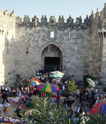
As we continue our walk, Damascus Gate soon comes into view. From the top of the wall we can see how the Damascus Gate is more richly ornamented than the other city gates.
Let us climb down into the pleasant park area for a closer inspection of the gate itself.
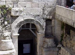
The Damascus Gate (#2 on map) is the only gate of Old Jerusalem that is still located as it was in ancient times. In fact, on the east side of the gate we can still see one of the three Roman gates that were constructed at this site. We realize from the picture why it has been called the “most elaborate” of the city gates.
Damascus Gate
One of the three Roman Gates underneath
“Pray for the peace of Jerusalem: May those who love you be secure” (Psalm 122:6).
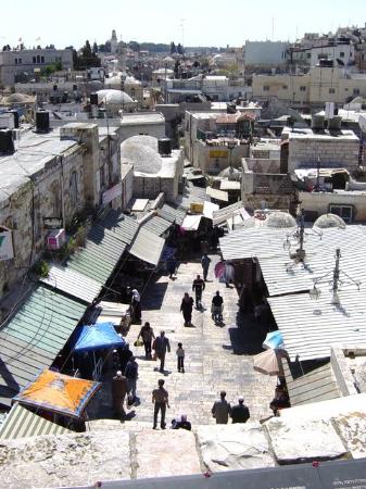
Now let us mount the gate and peek over the top for a quick look inside the Muslim Quarter. Soon after one enters Damascus Gate the street branches out to the southeast toward the Temple Mount. Then it goes on to the vicinity of the present-day Dung Gate. The other branch runs southwest along the path of the Roman/Byzantine Cardo or market street. Much of this Cardo has been excavated and new businesses have now opened up along it. This southwestern branch of the Cardo ran in the direction of the Zion Gate.
Damascus Gate was also the beginning of the roadway from Jerusalem to Nablus (Shechem) and on to Damascus in Syria. In Roman times there was a post situated at the gate with an image of Caesar upon it. From that point all mileage measurements were made to the various cities throughout the country. In Arabic the gate is still called Bab-el Amud, or Gate of the Column.
When we stand on the wall at the Damascus Gate, we can turn around and look across Sultan Suleiman Street (which now runs along the northern city wall) and see where Nablus (Shechem) Road begins and proceeds to the north.
The beginning of Nablus (Shechem) Road
Just a short distance up Nablus Road and on the right is the Garden Tomb. This site was brought to light by the British General, Charles Gordon, in 1883. It quickly became an alternate location for the place of crucifixion and burial of Jesus. Of particular interest to Gordon was the presence of a rock cut tomb and the unusual shape of the rocky hill that resembled a skull. Today this location is operated by the Garden Tomb Association and is a favorite place for Christian groups to come, observe, meditate and worship.
The Garden Tomb
Just to the east of the Damascus Gate and situated along the very top of the wall is the Spafford Children’s Center. This center resulted from the sacrificial work of Horatio and Anna Spafford. They came to Palestine from the US in 1881, with family and friends. The Spaffords had suffered a string of family disasters before deciding to come to the land, including the loss of four of their children at sea. As a result of this loss, Horatio Spafford wrote the endearing lyrics of the Christian hymn, It is Well With My Soul. Because of their work, what is known as The American Colony, north of the Damascus Gate, came into being. The popular American Colony Hotel is also still in operation.
In the distance is the Spafford Children’s Center atop the wall
“The Sovereign LORD declares– he who gathers the exiles of Israel: ‘I will gather still others to them besides those already gathered’” (Isaiah 56:8)
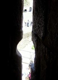
As we walk let us take a quick look out through the ramparts of the wall. Here we can glimpse what ancient archers must have seen as they once defended this gate and the city.
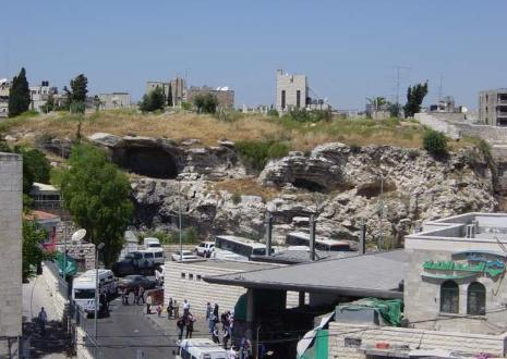
Immediately to the east of Damascus Gate and beneath the wall is Zedekiah’s Cave. This cave got its name from the tradition that King Zedekiah used the cave in his futile attempt to escape from the Babylonian army in 586 BC. Today the cave, which was also an ancient rock quarry, is open for visitors.
A quick look over the wall will let us see the Hill of the Skull (Mt. 27:33) that we spoke of earlier. Unfortunately, this site of reflection and meditation is located next door to the busy and noisy Arab bus station.
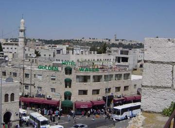
As we stroll a little further we continue along Sultan Suleiman Street in Arab East Jerusalem. We look down on the Golden Walls Hotel and more of the shopping area of
the city.
Sultan Suleiman Street
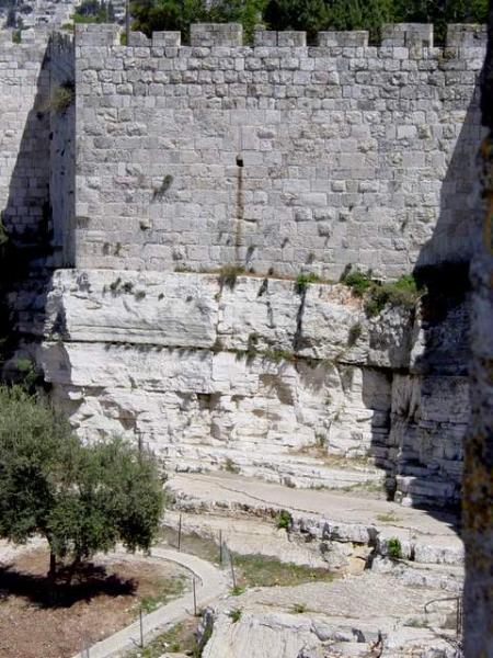
Let us now walk further on our journey to Herod’s Gate, we realize that our wall has taken a short turn inward and that the wall itself at this point is not very tall since it is situated on a massive rock escarpment. The area below the wall was part of a very large rock quarry in ancient times and likely many stones that formed the Temple and the Temple area were taken from this quarry (1 Ki. 5:15-17). The quarry actually extended across the road into the area of the bus station. When the Crusaders arrived they turned the quarry into a moat which ran along much of the northern wall.
“See, I lay a stone in Zion, a tested stone, a precious cornerstone for a sure foundation; the one who trusts will never be dismayed” (Isaiah 28:16).
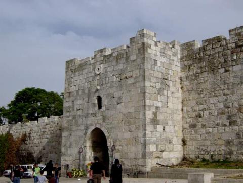
Now we are approaching Herod’s Gate and we can see the vehicular traffic parking at the small gate to load and unload.
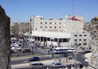
Across from Herod’s Gate, Salah E-Din Street branches off from Suleiman Street. This street is also a popular shopping area for Jerusalem’s Arab population.
Salah E-Din Street branching off and the East Jerusalem Post Office
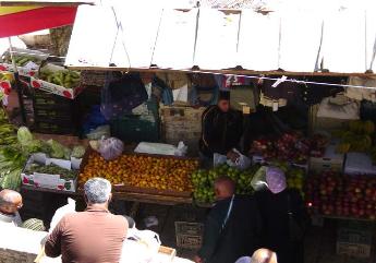
At Herod’s Gate (#3 on the map) we can look down on the Arab market just inside. We realize once more that the walls of the Old City which themselves look so stoic actually enclose a bustling populace. Let us make our way down to ground level.
Herod’s Gate
The name of Herod’s Gate in Arabic is Bab ez-Sahr “The Flowered Gate.” If we look toward the top of it we can make out the flower symbol. In the 16th and 17th centuries this opening got its name “Herod’s Gate” because pilgrims came to believe that Herod had a palace in this area. Actually, the gate probably didn’t even exist in Herod’s time. For many years the gate was just a wicket opening out of the eastern side of the tower in order to ease traffic flow from this crowded section. The front part of the gate was not opened until 1875. It is of note that in this area the Crusaders under Godfrey of Bouillon breached the older wall in 1099.
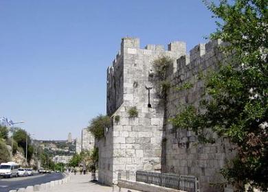
Now let us walk just a little further on the ground level in order that we might view and appreciate the beauty of the northern wall.
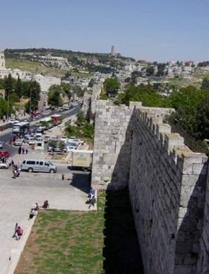
A ground level look at the northern wall as it approaches the Mount of Olives
Then let us get up on the wall again because we have a much better view from the top. As we walk we realize that we are getting closer to the eastern end of the wall. By looking out over the Muslim Quarter once more, we get our first unobstructed view of the Mount of Olives to the east of us.
We note the Seven Arches Hotel (formerly the Intercontinental Hotel) on the very top. Down below are the onion-shaped golden domes of the Russian Church of Mary Magdalene. We will get a much better view of the whole Mount of Olives as we later stroll down the eastern wall.
As we glance back to the north side of our wall and across Suleiman Street, we notice the Rockefeller Museum with its white octagonal tower. It was the first archaeological museum in Palestine and was established after 1930 by the British. Just as we pass the museum area we see that our city wall is about to make its turn to the south.
The Rockefeller Museum
We find ourselves looking at the street intersection of El Muqdasi, Jericho Road, and Derekh E-Tur, which at this point runs on across the Kidron Valley. To keep ourselves oriented we are looking once more at the tower of Augusta Victoria with the Mormon University and its many arches just below it and to the left.
Street intersection with El Muqdasi, Jericho Road, and Derekh E-Tur
